Earthquake Flores Region, Indonesia
Mon, 09 Feb 2026 19:47:36 GMT
Time1 hour ago
Location
-8.8801, 123.9837
Depth
80.9 KM
Event Summary
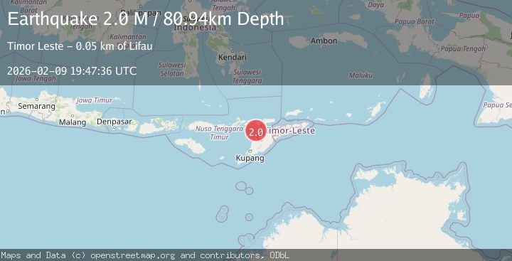
A 2.0 magnitude earthquake struck on Flores Region, Indonesia, at Mon, 09 Feb 2026 19:47:36 GMT. Depth: 80.937462km. Reviewed by BMKG seismologists, this minor quake occurred at a magnitude type of M.
Magnitude
2.0
M
Source
BMKG
Intensity
-
Agency Reports
1 Sources| Source | Magnitude | Depth | Time |
|---|---|---|---|
| BMKGPrimary | 2.0 | 81 km | 1 hour ago |
Earthquake Details
AutomaticEvent IDbmg2026cutu
Tsunami PotentialNo
Magnitude TypeM
Nearest Places
- Tanjung Boda37.4 km
- Tanjung Delaki37.7 km
- Kukka Delaaki39.8 km
- Delaki40.4 km
- Tanjung Aliadung40.5 km
Comments
Join the discussion about this event.
Latest Earthquakes
1.1Mag
8 km SSW of Mojave, CA
Time1 hour ago
Depth1.87 km
SourceUSGS (Automatic)
1.8Mag
11 km SE of Pāhala, Hawaii
Time1 hour ago
Depth32.48 km
SourceUSGS (Automatic)
3.6Mag
RYUKYU ISLANDS, JAPAN
Time1 hour ago
Depth10.00 km
SourceJMA (Automatic)
1.3Mag
4 km SSE of Mentone, CA
Time1 hour ago
Depth10.32 km
SourceUSGS (Automatic)
3.1Mag
ARUNACHAL PRADESH, INDIA
Time1 hour ago
Depth10.00 km
SourceNDI (Automatic)
Nearby Earthquakes
2.1Mag
Timor Region
Time3 days ago
Depth75.54 km
SourceBMKG (Automatic)
2.7Mag
Flores Region, Indonesia
Time2 weeks ago
Depth6.99 km
SourceBMKG (Automatic)
3.2Mag
Flores Region, Indonesia
Time2 weeks ago
Depth82.44 km
SourceBMKG (Automatic)
2.5Mag
Flores Region, Indonesia
Time2 weeks ago
Depth51.05 km
SourceBMKG (Automatic)
2.6Mag
Timor Region
Time2 weeks ago
Depth83.16 km
SourceBMKG (Automatic)