Earthquake Timor Region
Tue, 10 Feb 2026 00:38:18 GMT
Time1 hour ago
Location
-8.8757, 124.1039
Depth
81.6 KM
Event Summary
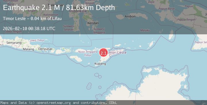
A 2.1 magnitude earthquake struck on Timor Region, at Tue, 10 Feb 2026 00:38:18 GMT. Depth: 81.63459km. Reviewed by BMKG seismologists, this minor quake occurred at a magnitude type of M.
Magnitude
2.1
M
Source
BMKG
Intensity
-
Agency Reports
1 Sources| Source | Magnitude | Depth | Time |
|---|---|---|---|
| BMKGPrimary | 2.1 | 82 km | 1 hour ago |
Earthquake Details
AutomaticEvent IDbmg2026cvdk
Tsunami PotentialNo
Magnitude TypeM
Nearest Places
- Tanjung Delaki36.4 km
- Tanjung Boda36.7 km
- Tanjung Bataamin37.8 km
- Tanjung Lahaja38.2 km
- Kukka Delaaki38.2 km
Comments
Join the discussion about this event.
Latest Earthquakes
2.5Mag
11 km SSW of Bolinas, CA
Time1 hour ago
Depth10.55 km
SourceUSGS (Automatic)
2.5Mag
Flores Region, Indonesia
Time1 hour ago
Depth141.12 km
SourceBMKG (Automatic)
2.6Mag
OFFSHORE EL SALVADOR
Time1 hour ago
Depth27.00 km
SourceINET (Automatic)
1.9Mag
14 km ESE of Pāhala, Hawaii
Time1 hour ago
Depth28.57 km
SourceUSGS (Automatic)
0.8Mag
2 km N of The Geysers, CA
Time1 hour ago
Depth1.30 km
SourceUSGS (Automatic)
Nearby Earthquakes
2.3Mag
Timor Region
Time1 week ago
Depth59.59 km
SourceBMKG (Automatic)
2.1Mag
Timor Region
Time3 days ago
Depth75.54 km
SourceBMKG (Automatic)
3.8Mag
Timor Region
Time1 week ago
Depth77.41 km
SourceBMKG (Automatic)
3.3Mag
Timor Region
Time2 weeks ago
Depth47.49 km
SourceBMKG (Automatic)
2.6Mag
Timor Region
Time2 weeks ago
Depth83.16 km
SourceBMKG (Automatic)