Earthquake north of Halmahera, Indonesia
Sun, 15 Feb 2026 17:57:56 GMT
Time2 days ago
Location
4.2921, 128.2579
Depth
10.0 KM
Event Summary
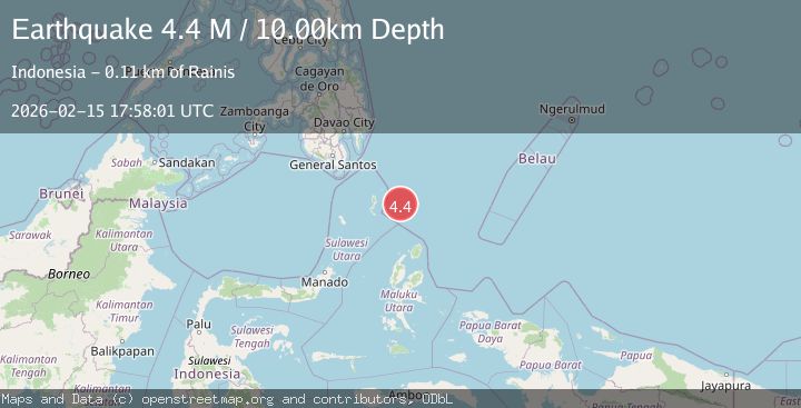
A 4.4 magnitude earthquake struck on north of Halmahera, Indonesia, at Sun, 15 Feb 2026 17:57:56 GMT. Depth: 10km. Reviewed by VYT seismologists, this light quake occurred at a magnitude type of earthquake.
Magnitude
4.4
earthquake
Source
VYT
Intensity
-
Agency Reports
2 Sources| Source | Magnitude | Depth | Time |
|---|---|---|---|
| VYTPrimary | 3.8 | 10 km | 2 days ago |
| BMKG | 4.4 | 10 km | 2 days ago |
Earthquake Details
AutomaticEvent IDvyt_16laquvbfxsze
Tsunami PotentialNo
Magnitude Typeearthquake
Nearest Places
- Snellius Ridge43.3 km
- Talaud Trough98.8 km
- Pulau Kakorotan127.3 km
- Desa Kakorotan127.3 km
- Pulau Intata128.0 km
Comments
Join the discussion about this event.
Latest Earthquakes
2.4Mag
Antofagasta, Chile
Time20 hours ago
Depth0.00 km
SourceVYT (Automatic)
2.0Mag
Southern Alaska
Time20 hours ago
Depth43.70 km
SourceVYT (Automatic)
3.4Mag
Alaska Peninsula
Time20 hours ago
Depth0.12 km
SourceVYT (Automatic)
2.4Mag
Central Alaska
Time20 hours ago
Depth176.64 km
SourceVYT (Automatic)
1.1Mag
13 km ENE of Cloverdale, CA
Time20 hours ago
Depth2.05 km
SourceUSGS (Automatic)
Nearby Earthquakes
4.7Mag
north of Halmahera, Indonesia
Time2 days ago
Depth10.00 km
SourceVYT (Automatic)
3.9Mag
NORTH OF HALMAHERA, INDONESIA
Time4 days ago
Depth25.00 km
SourceBMKG (Automatic)
4.1Mag
North of Halmahera, Indonesia
Time1 day ago
Depth10.00 km
SourceBMKG
4.6Mag
North of Halmahera, Indonesia
Time4 days ago
Depth21.15 km
SourceBMKG
4.4Mag
North of Halmahera, Indonesia
Time5 days ago
Depth19.48 km
SourceBMKG