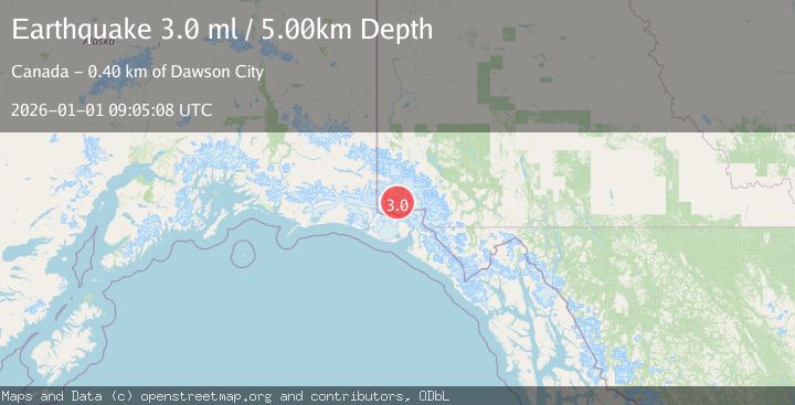
Earthquake SOUTHERN YUKON TERRITORY, CANADA
Thu, 01 Jan 2026 09:05:08 GMT
Time1 month ago
Location
60.4991, -140.1514
Depth
5.0 KM
Event Summary
A 3.0 magnitude earthquake struck on SOUTHERN YUKON TERRITORY, CANADA, at Thu, 01 Jan 2026 09:05:08 GMT. Depth: 5km. Reviewed by NEIC seismologists, this minor quake occurred at a magnitude type of ml.
Magnitude
3.0
ml
Source
NEIC
Intensity
-
Agency Reports
1 Sources| Source | Magnitude | Depth | Time |
|---|---|---|---|
| NEICPrimary | 3.0 | 7 km | 1 month ago |
Earthquake Details
AutomaticEvent IDemsc_NEIC_20260101_0000150
Tsunami PotentialNo
Magnitude Typeml
Nearest Places
- Marker Lake9.1 km
- McArthur Peak12.4 km
- Mount Logan15.8 km
- Mount King George20.2 km
- Corwin Cliffs24.0 km
Comments
Join the discussion about this event.
Latest Earthquakes
2.1Mag
Sulawesi, Indonesia
Time53 minutes ago
Depth5.00 km
SourceBMKG
2.7Mag
Southern Sumatra, Indonesia
Time1 hour ago
Depth39.33 km
SourceBMKG
4.0Mag
SIBUYAN SEA, PHILIPPINES
Time1 hour ago
Depth10.00 km
SourcePIVS (Automatic)
1.8Mag
Southern Alaska
Time1 hour ago
Depth51.51 km
SourceVYT (Automatic)
1.9Mag
11 km E of Pāhala, Hawaii
Time1 hour ago
Depth30.61 km
SourceUSGS (Automatic)
Nearby Earthquakes
1.8Mag
Southeastern Alaska
Time6 days ago
Depth0.00 km
SourceVYT (Automatic)
2.7Mag
SOUTHERN YUKON TERRITORY, CANADA
Time1 month ago
Depth5.00 km
SourceNEIC (Automatic)
3.0Mag
SOUTHERN YUKON TERRITORY, CANADA
Time1 month ago
Depth5.00 km
SourceNEIC (Automatic)
1.8Mag
Southeastern Alaska
Time1 day ago
Depth13.79 km
SourceVYT (Automatic)
2.5Mag
SOUTHERN YUKON TERRITORY, CANADA
Time1 month ago
Depth5.00 km
SourceNEIC (Automatic)