Earthquake Southeastern Alaska
Mon, 16 Feb 2026 21:38:55 GMT
Time1 day ago
Location
60.5126, -140.1733
Depth
13.8 KM
Event Summary
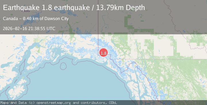
A 1.8 magnitude earthquake struck on Southeastern Alaska, at Mon, 16 Feb 2026 21:38:55 GMT. Depth: 13.7939453125km. Reviewed by VYT seismologists, this minor quake occurred at a magnitude type of earthquake.
Magnitude
1.8
earthquake
Source
VYT
Intensity
-
Agency Reports
1 Sources| Source | Magnitude | Depth | Time |
|---|---|---|---|
| VYTPrimary | 1.8 | 14 km | 1 day ago |
Earthquake Details
AutomaticEvent IDvyt_18xcs1yncessh
Tsunami PotentialNo
Magnitude Typeearthquake
Nearest Places
- Marker Lake10.2 km
- McArthur Peak10.6 km
- Mount Logan14.1 km
- Mount King George21.2 km
- Corwin Cliffs25.1 km
Comments
Join the discussion about this event.
Latest Earthquakes
1.7Mag
Southern Alaska
Time13 hours ago
Depth17.09 km
SourceVYT (Automatic)
5.5Mag
Kepulauan Tanimbar, Indonesia
Time13 hours ago
Depth146.36 km
SourceVYT (Automatic)
2.4Mag
Java, Indonesia
Time13 hours ago
Depth27.20 km
SourceBMKG
1.8Mag
49 km NW of Toyah, Texas
Time13 hours ago
Depth3.95 km
SourceUSGS (Automatic)
2.5Mag
offshore Valparaiso, Chile
Time13 hours ago
Depth0.00 km
SourceVYT (Automatic)
Nearby Earthquakes
1.8Mag
Southeastern Alaska
Time6 days ago
Depth0.00 km
SourceVYT (Automatic)
3.5Mag
SOUTHERN YUKON TERRITORY, CANADA
Time1 month ago
Depth5.00 km
SourceNEIC (Automatic)
3.0Mag
SOUTHERN YUKON TERRITORY, CANADA
Time1 month ago
Depth5.00 km
SourceNEIC (Automatic)
3.0Mag
SOUTHERN YUKON TERRITORY, CANADA
Time1 month ago
Depth5.00 km
SourceNEIC (Automatic)
3.1Mag
112 km NNW of Yakutat, Alaska
Time1 week ago
Depth11.30 km
SourceUSGS