Earthquake SOUTHERN ALASKA
Sat, 17 Jan 2026 14:06:02 GMT
Time1 month ago
Location
60.9422, -147.1307
Depth
35.0 KM
Event Summary
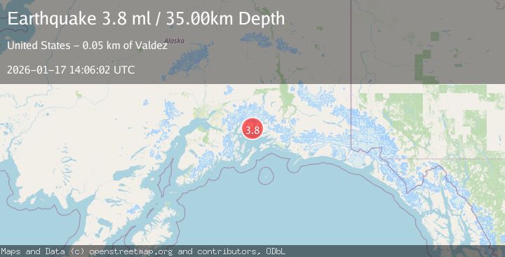
A 3.8 magnitude earthquake struck on SOUTHERN ALASKA, at Sat, 17 Jan 2026 14:06:02 GMT. Depth: 35km. Reviewed by NEIC seismologists, this minor quake occurred at a magnitude type of ml.
Magnitude
3.8
ml
Source
NEIC
Intensity
-
Agency Reports
1 Sources| Source | Magnitude | Depth | Time |
|---|---|---|---|
| NEICPrimary | 3.8 | 35 km | 1 month ago |
Earthquake Details
AutomaticEvent IDemsc_NEIC_20260117_0000145
Tsunami PotentialNo
Magnitude Typeml
Nearest Places
- Flent Point0.4 km
- Heather Bay2.1 km
- Long Point2.7 km
- Elder Point3.1 km
- Useless Cove3.2 km
Comments
Join the discussion about this event.
Latest Earthquakes
2.2Mag
Seram, Indonesia
Time14 hours ago
Depth19.61 km
SourceBMKG
2.2Mag
Sweden
Time14 hours ago
Depth0.00 km
SourceVYT (Automatic)
1.5Mag
Southeastern Alaska
Time14 hours ago
Depth0.00 km
SourceVYT (Automatic)
1.6Mag
5 km NNW of Boron, CA
Time14 hours ago
Depth-0.63 km
SourceUSGS (Automatic)
2.3Mag
Ceram Sea
Time14 hours ago
Depth10.00 km
SourceBMKG
Nearby Earthquakes
3.2Mag
22 km WNW of Tatitlek, Alaska
Time3 weeks ago
Depth18.30 km
SourceUSGS (Automatic)
2.1Mag
22 km WNW of Tatitlek, Alaska
Time3 weeks ago
Depth20.30 km
SourceUSGS (Automatic)
4.4Mag
SOUTHERN ALASKA
Time3 weeks ago
Depth20.00 km
SourceAK (Automatic)
3.0Mag
SOUTHERN ALASKA
Time1 year ago
Depth22.60 km
SourceNEIC (Automatic)
1.2Mag
Southern Alaska
Time6 days ago
Depth31.37 km
SourceVYT (Automatic)