Earthquake 22 km WNW of Tatitlek, Alaska
Thu, 22 Jan 2026 15:53:19 GMT
Time4 days ago
Location
60.9290, -147.0650
Depth
18.3 KM
Event Summary
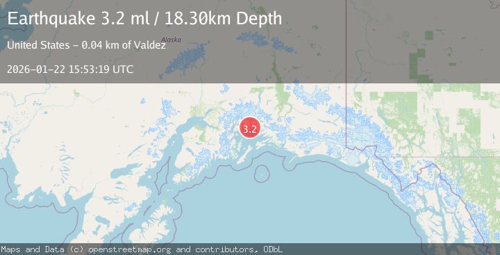
A 3.2 magnitude earthquake struck on 22 km WNW of Tatitlek, Alaska, at Thu, 22 Jan 2026 15:53:19 GMT. Depth: 18.3km. Reviewed by USGS seismologists, this minor quake occurred at a magnitude type of ml.
Magnitude
3.2
ml
Source
USGS
Intensity
-
Agency Reports
2 Sources| Source | Magnitude | Depth | Time |
|---|---|---|---|
| USGSPrimary | 3.2 | 18 km | 4 days ago |
| AK | 3.2 | 18 km | 4 days ago |
Earthquake Details
AutomaticEvent IDusgs_ak2026bntvzl
Tsunami PotentialNo
Magnitude Typeml
Nearest Places
- Elf Point1.8 km
- Heather Bay2.0 km
- Round Mountain2.7 km
- Lutris Pass3.3 km
- Emerald Cove3.3 km
Comments
Join the discussion about this event.
Latest Earthquakes
1.1Mag
30 km NE of Los Alamos, CA
Time12 minutes ago
Depth4.17 km
SourceUSGS (Automatic)
1.2Mag
EASTERN TURKEY
Time12 minutes ago
Depth7.00 km
SourceAFAD (Automatic)
2.6Mag
Timor Region
Time15 minutes ago
Depth35.26 km
SourceBMKG (Automatic)
2.3Mag
Sumbawa Region, Indonesia
Time15 minutes ago
Depth10.00 km
SourceBMKG (Automatic)
2.5Mag
Flores Sea
Time17 minutes ago
Depth26.93 km
SourceBMKG (Automatic)
Nearby Earthquakes
2.1Mag
22 km WNW of Tatitlek, Alaska
Time20 hours ago
Depth20.30 km
SourceUSGS (Automatic)
4.4Mag
SOUTHERN ALASKA
Time21 hours ago
Depth20.00 km
SourceAK (Automatic)
1.8Mag
22 km NW of Tatitlek, Alaska
Time9 hours ago
Depth13.70 km
SourceUSGS
1.8Mag
15 km NNW of Tatitlek, Alaska
Time10 hours ago
Depth8.00 km
SourceUSGS (Automatic)
1.3Mag
47 km WNW of Tatitlek, Alaska
Time3 days ago
Depth5.00 km
SourceUSGS (Automatic)