Earthquake WESTERN TEXAS
Tue, 27 Jan 2026 17:39:07 GMT
Time3 hours ago
Location
32.0190, -101.3440
Depth
1.7 KM
Event Summary
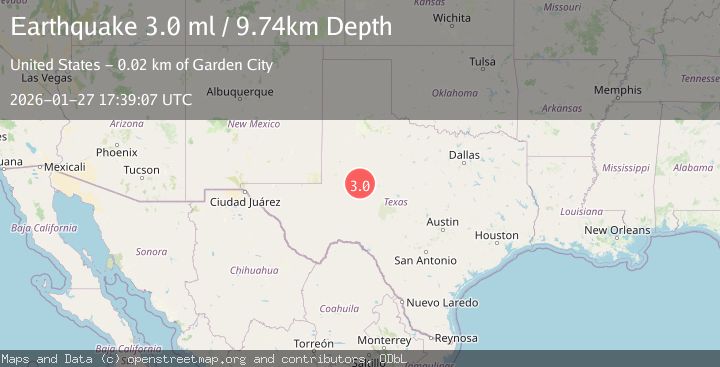
A 2.8 magnitude earthquake struck on WESTERN TEXAS, at Tue, 27 Jan 2026 17:39:07 GMT. Depth: 1.7km. Reviewed by TX seismologists, this minor quake occurred at a magnitude type of ml.
Magnitude
2.8
ml
Source
TX
Intensity
-
Agency Reports
2 Sources| Source | Magnitude | Depth | Time |
|---|---|---|---|
| TXPrimary | 2.8 | 2 km | 3 hours ago |
| USGS | 2.8 | 2 km | 3 hours ago |
Earthquake Details
AutomaticEvent IDemsc_TX_20260127_0000322
Tsunami PotentialNo
Magnitude Typeml
Nearest Places
- Cannibal Draw3.9 km
- Foster Ranch6.5 km
- Big Spring City Wells7.3 km
- Howard Glasscock Oil Field9.0 km
- Ross City9.3 km
Comments
Join the discussion about this event.
Latest Earthquakes
3.1Mag
Minahassa Peninsula, Sulawesi
Time3 hours ago
Depth5.00 km
SourceBMKG (Automatic)
1.8Mag
7 km SW of Furnace Creek, California
Time3 hours ago
Depth4.54 km
SourceUSGS (Automatic)
2.3Mag
Flores Sea
Time3 hours ago
Depth17.26 km
SourceBMKG (Automatic)
2.6Mag
PAPUA, INDONESIA
Time3 hours ago
Depth10.00 km
SourceBMKG (Automatic)
2.2Mag
10 km WNW of The Geysers, CA
Time3 hours ago
Depth1.35 km
SourceUSGS (Automatic)
Nearby Earthquakes
1.9Mag
10 km S of Forsan, Texas
Time4 days ago
Depth0.90 km
SourceUSGS (Automatic)
1.3Mag
3 km NNW of Garden City, Texas
Time1 day ago
Depth1.26 km
SourceUSGS (Automatic)
1.2Mag
4 km SE of Big Spring, Texas
Time4 days ago
Depth3.06 km
SourceUSGS (Automatic)
1.7Mag
27 km S of Westbrook, Texas
Time5 days ago
Depth4.23 km
SourceUSGS (Automatic)
1.8Mag
26 km S of Westbrook, Texas
Time1 day ago
Depth2.88 km
SourceUSGS (Automatic)