Earthquake 84 km NNW of Karluk, Alaska
Sat, 17 Jan 2026 09:40:56 GMT
Time2 hours ago
Location
58.2770, -154.9840
Depth
5.0 KM
Event Summary
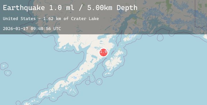
A 2.1 magnitude earthquake struck on 84 km NNW of Karluk, Alaska, at Sat, 17 Jan 2026 09:40:56 GMT. Depth: 5km. Reviewed by USGS seismologists, this minor quake occurred at a magnitude type of ml.
Magnitude
2.1
ml
Source
USGS
Intensity
-
Agency Reports
2 Sources| Source | Magnitude | Depth | Time |
|---|---|---|---|
| USGSPrimary | 1.0 | 5 km | 2 hours ago |
| USGSPrimary | 2.1 | 34 km | 1 hour ago |
Earthquake Details
AutomaticEvent IDusgs_ak2026becwrx
Tsunami PotentialNo
Magnitude Typeml
Nearest Places
- Crater Lake1.6 km
- The Knife Creek Glaciers1.8 km
- Mount Katmai1.9 km
- The Knife Creek Glacier3.4 km
- Noisy Glacier7.1 km
Comments
Join the discussion about this event.
Latest Earthquakes
2.1Mag
31 km NW of Toyah, Texas
Time5 minutes ago
Depth4.46 km
SourceUSGS (Automatic)
3.1Mag
Off West Coast of Northern Sumatra
Time16 minutes ago
Depth40.28 km
SourceBMKG (Automatic)
2.5Mag
HONDURAS
Time17 minutes ago
Depth11.00 km
SourceINET (Automatic)
2.2Mag
Flores Region, Indonesia
Time18 minutes ago
Depth11.17 km
SourceBMKG (Automatic)
3.6Mag
West Papua Region, Indonesia
Time21 minutes ago
Depth10.00 km
SourceBMKG (Automatic)