Earthquake 38 km NW of Karluk, Alaska
Sun, 18 Jan 2026 04:36:12 GMT
Time2 hours ago
Location
57.8390, -154.8470
Depth
67.7 KM
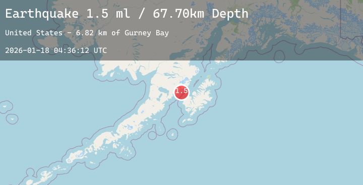
Event Summary
A 1.5 magnitude earthquake struck on 38 km NW of Karluk, Alaska, at Sun, 18 Jan 2026 04:36:12 GMT. Depth: 67.7km. Reviewed by USGS seismologists, this minor quake occurred at a magnitude type of ml.
Magnitude
1.5
ml
Source
USGS
Intensity
-
Agency Reports
1 Sources| Source | Magnitude | Depth | Time |
|---|---|---|---|
| USGSPrimary | 1.5 | 68 km | 2 hours ago |
Earthquake Details
AutomaticEvent IDusgs_ak2026bfomzp
Tsunami PotentialNo
Magnitude Typeml
Nearest Places
- Gurney Bay6.8 km
- Cape Kubugakli14.3 km
- Katmai Bay17.6 km
- Kashvik Bay17.7 km
- Mount Kubugakli17.8 km
Comments
Join the discussion about this event.
Latest Earthquakes
2.5Mag
TARAPACA, CHILE
Time2 hours ago
Depth80.00 km
SourceCSN (Automatic)
2.1Mag
Sumbawa Region, Indonesia
Time2 hours ago
Depth17.05 km
SourceBMKG (Automatic)
0.3Mag
5 km SSW of Idyllwild, CA
Time2 hours ago
Depth16.91 km
SourceUSGS (Automatic)
1.1Mag
4 km NNW of The Geysers, CA
Time2 hours ago
Depth1.28 km
SourceUSGS (Automatic)
5.5Mag
Northern Molucca Sea
Time2 hours ago
Depth44.24 km
SourceBMKG (Automatic)
Nearby Earthquakes
2.3Mag
98 km NNW of Karluk, Alaska
Time4 hours ago
Depth0.00 km
SourceUSGS (Automatic)
1.5Mag
98 km NNW of Karluk, Alaska
Time11 hours ago
Depth5.00 km
SourceUSGS (Automatic)
2.1Mag
58 km SSE of King Salmon, Alaska
Time18 hours ago
Depth7.50 km
SourceUSGS (Automatic)
2.1Mag
84 km NNW of Karluk, Alaska
Time21 hours ago
Depth5.00 km
SourceUSGS (Automatic)