Earthquake 15 km NNW of Tatitlek, Alaska
Mon, 26 Jan 2026 22:02:05 GMT
Time9 hours ago
Location
60.9910, -146.7870
Depth
8.0 KM
Event Summary
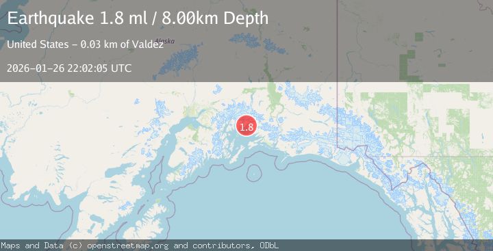
A 1.8 magnitude earthquake struck on 15 km NNW of Tatitlek, Alaska, at Mon, 26 Jan 2026 22:02:05 GMT. Depth: 8km. Reviewed by USGS seismologists, this minor quake occurred at a magnitude type of ml.
Magnitude
1.8
ml
Source
USGS
Intensity
-
Agency Reports
1 Sources| Source | Magnitude | Depth | Time |
|---|---|---|---|
| USGSPrimary | 1.8 | 8 km | 9 hours ago |
Earthquake Details
AutomaticEvent IDusgs_ak2026bvozhi
Tsunami PotentialNo
Magnitude Typeml
Nearest Places
- Valdez Arm2.0 km
- Rocky Point4.0 km
- Rocky Point Light4.6 km
- Point Lowe6.0 km
- Devish Lake6.2 km
Comments
Join the discussion about this event.
Latest Earthquakes
2.0Mag
Minahassa Peninsula, Sulawesi
Time9 hours ago
Depth3.11 km
SourceBMKG (Automatic)
4.7Mag
New Guinea, Papua New Guinea
Time9 hours ago
Depth48.69 km
SourceBMKG (Automatic)
2.3Mag
Flores Sea
Time9 hours ago
Depth21.75 km
SourceBMKG (Automatic)
2.2Mag
NEVADA
Time9 hours ago
Depth5.30 km
SourceNN (Automatic)
1.8Mag
13 km SSE of Volcano, Hawaii
Time9 hours ago
Depth3.46 km
SourceUSGS (Automatic)
Nearby Earthquakes
4.4Mag
SOUTHERN ALASKA
Time20 hours ago
Depth20.00 km
SourceAK (Automatic)
2.1Mag
22 km WNW of Tatitlek, Alaska
Time19 hours ago
Depth20.30 km
SourceUSGS (Automatic)
3.2Mag
22 km WNW of Tatitlek, Alaska
Time4 days ago
Depth18.30 km
SourceUSGS (Automatic)
2.3Mag
12 km WSW of Valdez, Alaska
Time2 days ago
Depth49.60 km
SourceUSGS (Automatic)
1.8Mag
29 km NW of Valdez, Alaska
Time2 days ago
Depth27.00 km
SourceUSGS (Automatic)