Earthquake 85 km N of Yakutat, Alaska
Sun, 08 Feb 2026 07:22:21 GMT
Time1 hour ago
Location
60.3080, -139.8890
Depth
0.4 KM
Event Summary
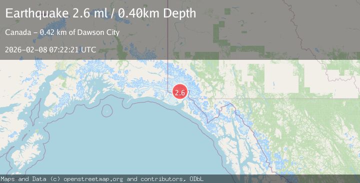
A 2.6 magnitude earthquake struck on 85 km N of Yakutat, Alaska, at Sun, 08 Feb 2026 07:22:21 GMT. Depth: 0.4km. Reviewed by USGS seismologists, this minor quake occurred at a magnitude type of ml.
Magnitude
2.6
ml
Source
USGS
Intensity
-
Agency Reports
1 Sources| Source | Magnitude | Depth | Time |
|---|---|---|---|
| USGSPrimary | 2.6 | 0 km | 1 hour ago |
Earthquake Details
AutomaticEvent IDusgs_ak2026csigqk
Tsunami PotentialNo
Magnitude Typeml
Nearest Places
- Mount Vancouver11.9 km
- Saint Elias Mountains12.0 km
- Mount Cook14.9 km
- Mount Cook15.0 km
- Valerie Glacier20.8 km
Comments
Join the discussion about this event.
Latest Earthquakes
2.9Mag
10 km SSW of Valencia, CA
Time4 minutes ago
Depth10.43 km
SourceUSGS (Automatic)
1.6Mag
10 km S of Forsan, Texas
Time16 minutes ago
Depth1.25 km
SourceUSGS (Automatic)
2.9Mag
Northern Molucca Sea
Time24 minutes ago
Depth1.52 km
SourceBMKG (Automatic)
2.6Mag
SERAM, INDONESIA
Time27 minutes ago
Depth10.00 km
SourceBMKG (Automatic)
2.4Mag
4 km SE of Devore, CA
Time31 minutes ago
Depth12.27 km
SourceUSGS (Automatic)
Nearby Earthquakes
1.9Mag
87 km N of Yakutat, Alaska
Time5 days ago
Depth5.00 km
SourceUSGS (Automatic)
4.1Mag
SOUTHERN YUKON TERRITORY, CANADA
Time1 week ago
Depth0.50 km
SourceAK (Automatic)
0.9Mag
88 km NNW of Yakutat, Alaska
Time2 weeks ago
Depth36.90 km
SourceUSGS (Automatic)
3.8Mag
SOUTHERN YUKON TERRITORY, CANADA
Time1 week ago
Depth5.20 km
SourceAK (Automatic)
1.8Mag
107 km N of Yakutat, Alaska
Time1 week ago
Depth10.50 km
SourceUSGS