Earthquake 9 km N of Banning, CA
Thu, 26 Feb 2026 00:14:33 GMT
Time1 hour ago
Location
34.0098, -116.8902
Depth
18.6 KM
Event Summary
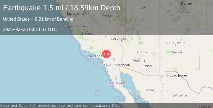
A 1.5 magnitude earthquake struck on 9 km N of Banning, CA, at Thu, 26 Feb 2026 00:14:33 GMT. Depth: 18.59km. Reviewed by USGS seismologists, this minor quake occurred at a magnitude type of ml.
Magnitude
1.5
ml
Source
USGS
Intensity
-
Agency Reports
1 Sources| Source | Magnitude | Depth | Time |
|---|---|---|---|
| USGSPrimary | 1.5 | 19 km | 1 hour ago |
Earthquake Details
AutomaticEvent IDusgs_ci41404000
Tsunami PotentialNo
Magnitude Typeml
Nearest Places
- 1.1 km
- 1.4 km
- 1.5 km
- 2.2 km
- 3.0 km
Comments
Join the discussion about this event.
Latest Earthquakes
3.7Mag
Potosi, Bolivia
Time1 hour ago
Depth240.11 km
SourceVYT (Automatic)
3.9Mag
Southern California
Time1 hour ago
Depth1.22 km
SourceVYT (Automatic)
0.7Mag
2 km NW of The Geysers, CA
Time1 hour ago
Depth3.63 km
SourceUSGS (Automatic)
1.2Mag
5 km NW of Boron, CA
Time1 hour ago
Depth-0.65 km
SourceUSGS (Automatic)
1.3Mag
northern Alaska
Time1 hour ago
Depth0.00 km
SourceVYT (Automatic)
Nearby Earthquakes
1.2Mag
9 km N of Banning, CA
Time5 days ago
Depth18.03 km
SourceUSGS (Automatic)
1.4Mag
8 km NNE of Banning, CA
Time1 month ago
Depth12.57 km
SourceUSGS (Automatic)
1.1Mag
12 km N of Banning, CA
Time2 weeks ago
Depth12.38 km
SourceUSGS (Automatic)
1.1Mag
5 km N of Banning, CA
Time3 days ago
Depth18.99 km
SourceUSGS (Automatic)
1.4Mag
12 km E of Yucaipa, CA
Time3 days ago
Depth15.73 km
SourceUSGS (Automatic)