Earthquake 9 km WNW of The Geysers, CA
Sat, 17 Jan 2026 04:00:46 GMT
Time1 hour ago
Location
38.8210, -122.8418
Depth
2.4 KM
Event Summary
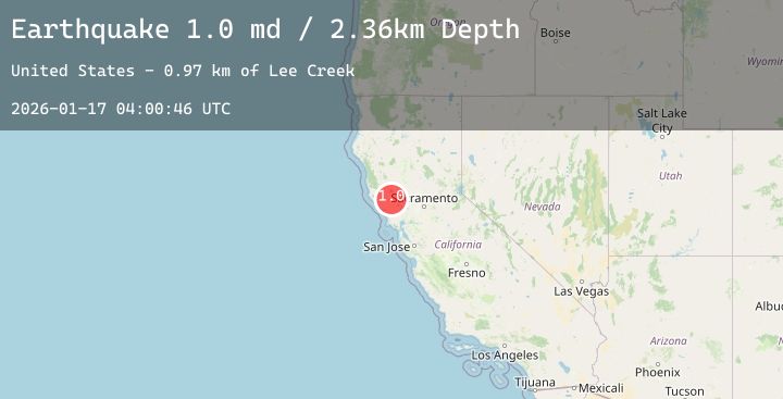
A 1.4 magnitude earthquake struck on 9 km WNW of The Geysers, CA, at Sat, 17 Jan 2026 04:00:46 GMT. Depth: 2.35999989509583km. Reviewed by USGS seismologists, this minor quake occurred at a magnitude type of md.
Magnitude
1.4
md
Source
USGS
Intensity
-
Agency Reports
4 Sources| Source | Magnitude | Depth | Time |
|---|---|---|---|
| USGSPrimary | 1.0 | 2 km | 1 hour ago |
| USGSPrimary | 0.7 | 2 km | 1 hour ago |
| USGSPrimary | 1.4 | 16 km | 1 hour ago |
| USGSPrimary | 1.1 | 4 km | 1 hour ago |
Earthquake Details
AutomaticEvent IDusgs_nc75296811
Tsunami PotentialNo
Magnitude Typemd
Nearest Places
- Black Oaks1.4 km
- Buckeye Mine1.4 km
- Truitt Creek1.5 km
- Adit Number One-One Hundred Twenty1.6 km
- Eagle Rock1.7 km
Comments
Join the discussion about this event.
Latest Earthquakes
2.7Mag
1 km SE of Point MacKenzie, Alaska
Time2 minutes ago
Depth22.90 km
SourceUSGS (Automatic)
1.1Mag
2 km NNW of The Geysers, CA
Time23 minutes ago
Depth3.48 km
SourceUSGS (Automatic)
3.1Mag
Halmahera, Indonesia
Time24 minutes ago
Depth2.40 km
SourceBMKG (Automatic)
2.5Mag
Northern Sumatra, Indonesia
Time25 minutes ago
Depth171.33 km
SourceBMKG (Automatic)
2.8Mag
MAULE, CHILE
Time31 minutes ago
Depth69.90 km
SourceCSN (Automatic)
Nearby Earthquakes
1.1Mag
2 km NNW of The Geysers, CA
Time23 minutes ago
Depth3.48 km
SourceUSGS (Automatic)
1.3Mag
7 km NW of The Geysers, CA
Time4 hours ago
Depth2.74 km
SourceUSGS (Automatic)
0.7Mag
6 km WNW of Cobb, CA
Time5 hours ago
Depth1.81 km
SourceUSGS (Automatic)
0.7Mag
8 km NW of The Geysers, CA
Time6 hours ago
Depth1.55 km
SourceUSGS (Automatic)
1.5Mag
9 km WNW of The Geysers, CA
Time7 hours ago
Depth2.03 km
SourceUSGS (Automatic)