Earthquake 15 km WSW of Petrolia, CA
Thu, 29 Jan 2026 03:50:16 GMT
Time2 hours ago
Location
40.2837, -124.4518
Depth
18.2 KM
Event Summary
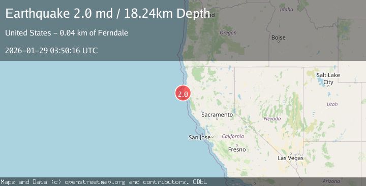
A 2.0 magnitude earthquake struck on 15 km WSW of Petrolia, CA, at Thu, 29 Jan 2026 03:50:16 GMT. Depth: 18.2399997711182km. Reviewed by USGS seismologists, this minor quake occurred at a magnitude type of md.
Magnitude
2.0
md
Source
USGS
Intensity
-
Agency Reports
1 Sources| Source | Magnitude | Depth | Time |
|---|---|---|---|
| USGSPrimary | 2.0 | 18 km | 2 hours ago |
Earthquake Details
AutomaticEvent IDusgs_nc75303521
Tsunami PotentialNo
Magnitude Typemd
Nearest Places
- Mattole Canyon0.2 km
- Christmas Rock6.6 km
- Conical Rock7.8 km
- Smith Gulch7.8 km
- Punta Gorda8.0 km
Comments
Join the discussion about this event.
Latest Earthquakes
2.1Mag
Java, Indonesia
Time5 minutes ago
Depth10.00 km
SourceBMKG (Automatic)
3.4Mag
Minahassa Peninsula, Sulawesi
Time12 minutes ago
Depth42.59 km
SourceBMKG (Automatic)
3.0Mag
CENTRAL ALASKA
Time13 minutes ago
Depth10.20 km
SourceAK (Automatic)
2.7Mag
Northern Sumatra, Indonesia
Time16 minutes ago
Depth14.71 km
SourceBMKG (Automatic)
2.5Mag
ISLAND OF HAWAII, HAWAII
Time17 minutes ago
Depth27.40 km
SourceHV (Automatic)
Nearby Earthquakes
1.9Mag
18 km W of Petrolia, CA
Time2 days ago
Depth18.85 km
SourceUSGS (Automatic)
2.3Mag
22 km W of Petrolia, CA
Time2 days ago
Depth11.53 km
SourceUSGS (Automatic)
1.6Mag
13 km NE of Hydesville, CA
Time3 days ago
Depth12.10 km
SourceUSGS (Automatic)
2.7Mag
OFFSHORE NORTHERN CALIFORNIA
Time6 days ago
Depth0.20 km
SourceNC (Automatic)
2.9Mag
86 km W of Petrolia, CA
Time2 days ago
Depth20.24 km
SourceUSGS (Automatic)