Earthquake 7 km NW of The Geysers, CA
Sun, 15 Feb 2026 19:16:12 GMT
Time2 days ago
Location
38.8223, -122.8098
Depth
1.2 KM
Event Summary
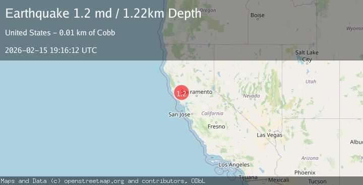
A 1.3 magnitude earthquake struck on 7 km NW of The Geysers, CA, at Sun, 15 Feb 2026 19:16:12 GMT. Depth: 1.22000002861023km. Reviewed by USGS seismologists, this minor quake occurred at a magnitude type of md.
Magnitude
1.3
md
Source
USGS
Intensity
-
Agency Reports
1 Sources| Source | Magnitude | Depth | Time |
|---|---|---|---|
| USGSPrimary | 1.3 | 1 km | 2 days ago |
Earthquake Details
AutomaticEvent IDusgs_nc75314332
Tsunami PotentialNo
Magnitude Typemd
Nearest Places
- Bear Canyon0.8 km
- Coldwater Canyon1.7 km
- Black Oaks2.2 km
- Geyser Canyon2.5 km
- Caldwell Pines2.6 km
Comments
Join the discussion about this event.
Latest Earthquakes
1.7Mag
2 km NW of The Geysers, CA
Time1 day ago
Depth0.79 km
SourceUSGS (Automatic)
2.4Mag
Northern Sumatra, Indonesia
Time1 day ago
Depth3.00 km
SourceBMKG
2.7Mag
SAN JUAN, ARGENTINA
Time1 day ago
Depth96.00 km
SourceNSNA (Automatic)
3.9Mag
near the north coast of Papua, Indonesia
Time1 day ago
Depth43.09 km
SourceVYT (Automatic)
2.2Mag
Antofagasta, Chile
Time1 day ago
Depth125.73 km
SourceVYT (Automatic)
Nearby Earthquakes
0.8Mag
7 km NW of The Geysers, CA
Time2 weeks ago
Depth2.90 km
SourceUSGS (Automatic)
0.8Mag
7 km NW of The Geysers, CA
Time5 days ago
Depth2.94 km
SourceUSGS (Automatic)
0.8Mag
7 km NW of The Geysers, CA
Time1 week ago
Depth2.83 km
SourceUSGS (Automatic)
0.8Mag
7 km NW of The Geysers, CA
Time6 days ago
Depth2.91 km
SourceUSGS (Automatic)
1.1Mag
7 km NW of The Geysers, CA
Time5 days ago
Depth2.27 km
SourceUSGS (Automatic)