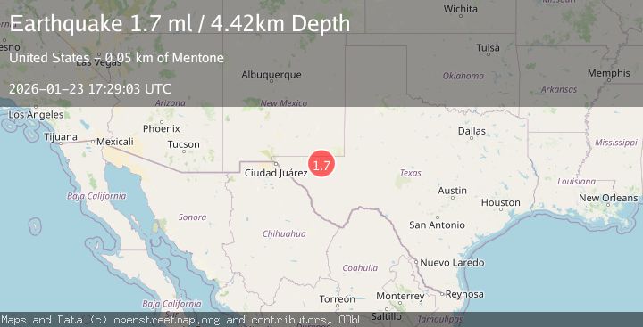
Earthquake 53 km W of Mentone, Texas
Fri, 23 Jan 2026 17:29:03 GMT
Time3 days ago
Location
31.6970, -104.1640
Depth
4.4 KM
Event Summary
A 1.7 magnitude earthquake struck on 53 km W of Mentone, Texas, at Fri, 23 Jan 2026 17:29:03 GMT. Depth: 4.4246km. Reviewed by USGS seismologists, this minor quake occurred at a magnitude type of ml.
Magnitude
1.7
ml
Source
USGS
Intensity
-
Agency Reports
1 Sources| Source | Magnitude | Depth | Time |
|---|---|---|---|
| USGSPrimary | 1.7 | 4 km | 3 days ago |
Earthquake Details
AutomaticEvent IDusgs_tx2026bpstib
Tsunami PotentialNo
Magnitude Typeml
Nearest Places
- Rustler Springs1.7 km
- Jose Tank2.1 km
- Rustler Hills2.8 km
- Monument Draw3.2 km
- Old Michigan Mine3.2 km
Comments
Join the discussion about this event.
Latest Earthquakes
3.7Mag
Java, Indonesia
Time9 minutes ago
Depth26.88 km
SourceBMKG (Automatic)
1.7Mag
20 km ENE of Arvin, CA
Time10 minutes ago
Depth5.64 km
SourceUSGS (Automatic)
2.3Mag
57 km E of Pedro Bay, Alaska
Time16 minutes ago
Depth120.40 km
SourceUSGS (Automatic)
2.3Mag
Bali Sea
Time17 minutes ago
Depth13.31 km
SourceBMKG (Automatic)
1.9Mag
97 km S of Kokhanok, Alaska
Time22 minutes ago
Depth5.00 km
SourceUSGS (Automatic)
Nearby Earthquakes
3.5Mag
55 km SSE of Whites City, New Mexico
Time2 days ago
Depth5.03 km
SourceUSGS (Automatic)
1.9Mag
54 km NW of Toyah, Texas
Time12 hours ago
Depth4.50 km
SourceUSGS (Automatic)
1.6Mag
50 km SSE of Whites City, New Mexico
Time4 days ago
Depth4.04 km
SourceUSGS (Automatic)
1.8Mag
55 km NW of Toyah, Texas
Time4 days ago
Depth4.58 km
SourceUSGS (Automatic)
1.7Mag
44 km NW of Toyah, Texas
Time3 days ago
Depth4.27 km
SourceUSGS (Automatic)