Earthquake 112 km N of Yakutat, Alaska
Fri, 16 Jan 2026 01:43:23 GMT
Time3 hours ago
Location
60.5532, -139.9593
Depth
5.0 KM
Event Summary
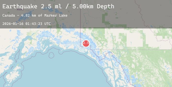
A 2.5 magnitude earthquake struck on 112 km N of Yakutat, Alaska, at Fri, 16 Jan 2026 01:43:23 GMT. Depth: 5km. Reviewed by USGS seismologists, this minor quake occurred at a magnitude type of ml.
Magnitude
2.5
ml
Source
USGS
Intensity
-
Agency Reports
1 Sources| Source | Magnitude | Depth | Time |
|---|---|---|---|
| USGSPrimary | 2.5 | 5 km | 3 hours ago |
Earthquake Details
ConfirmedEvent IDusgs_us7000rpzn
Tsunami PotentialNo
Magnitude Typeml
Nearest Places
- Marker Lake4.8 km
- Mount King George9.7 km
- McArthur Peak15.1 km
- Mount Queen Mary15.2 km
- Mount Logan24.4 km
Comments
Join the discussion about this event.
Latest Earthquakes
1.5Mag
30 km NW of Toyah, Texas
Time3 hours ago
Depth4.50 km
SourceUSGS (Automatic)
2.5Mag
ANTOFAGASTA, CHILE
Time3 hours ago
Depth183.50 km
SourceCSN (Automatic)
1.1Mag
CENTRAL TURKEY
Time4 hours ago
Depth7.10 km
SourceAFAD (Automatic)
1.5Mag
9 km ENE of Heber, CA
Time4 hours ago
Depth13.28 km
SourceUSGS (Automatic)
1.7Mag
5 km SE of Pearsall, Texas
Time4 hours ago
Depth5.47 km
SourceUSGS (Automatic)