Earthquake Southern Alaska
Mon, 23 Feb 2026 03:23:31 GMT
Time1 hour ago
Location
61.1131, -147.4725
Depth
58.5 KM
Event Summary
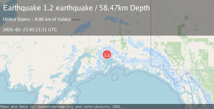
A 1.2 magnitude earthquake struck on Southern Alaska, at Mon, 23 Feb 2026 03:23:31 GMT. Depth: 58.4716796875km. Reviewed by VYT seismologists, this minor quake occurred at a magnitude type of earthquake.
Magnitude
1.2
earthquake
Source
VYT
Intensity
-
Agency Reports
1 Sources| Source | Magnitude | Depth | Time |
|---|---|---|---|
| VYTPrimary | 1.2 | 58 km | 1 hour ago |
Earthquake Details
AutomaticEvent IDvyt_1x1fam5o36gs7
Tsunami PotentialNo
Magnitude Typeearthquake
Nearest Places
- 2.6 km
- 3.9 km
- 5.0 km
- 5.0 km
- 5.3 km
Comments
Join the discussion about this event.
Latest Earthquakes
2.5Mag
Java, Indonesia
Time54 minutes ago
Depth93.36 km
SourceBMKG
2.2Mag
SAN FRANCISCO BAY AREA, CALIF.
Time56 minutes ago
Depth8.50 km
SourceNC (Automatic)
1.6Mag
16 km NW of Parkfield, CA
Time1 hour ago
Depth3.41 km
SourceUSGS (Automatic)
3.0Mag
West Papua Region, Indonesia
Time1 hour ago
Depth27.52 km
SourceBMKG
2.2Mag
CENTRAL ITALY
Time1 hour ago
Depth5.90 km
SourceINGV (Automatic)
Nearby Earthquakes
1.5Mag
52 km WNW of Tatitlek, Alaska
Time1 month ago
Depth7.30 km
SourceUSGS (Automatic)
1.4Mag
50 km WNW of Tatitlek, Alaska
Time3 weeks ago
Depth22.00 km
SourceUSGS (Automatic)
1.4Mag
51 km NW of Tatitlek, Alaska
Time3 weeks ago
Depth14.40 km
SourceUSGS (Automatic)
1.1Mag
53 km WNW of Tatitlek, Alaska
Time22 hours ago
Depth14.30 km
SourceUSGS (Automatic)
1.5Mag
48 km WNW of Tatitlek, Alaska
Time4 days ago
Depth5.00 km
SourceUSGS (Automatic)