Earthquake Southern Alaska
Fri, 13 Feb 2026 17:29:27 GMT
Time4 days ago
Location
61.5387, -152.3767
Depth
0.0 KM
Event Summary
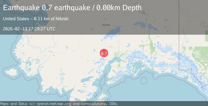
A 0.7 magnitude earthquake struck on Southern Alaska, at Fri, 13 Feb 2026 17:29:27 GMT. Depth: 0km. Reviewed by VYT seismologists, this minor quake occurred at a magnitude type of earthquake.
Magnitude
0.7
earthquake
Source
VYT
Intensity
-
Agency Reports
1 Sources| Source | Magnitude | Depth | Time |
|---|---|---|---|
| VYTPrimary | 0.7 | 0 km | 4 days ago |
Earthquake Details
AutomaticEvent IDvyt_2b1gfaw5bs1ux
Tsunami PotentialNo
Magnitude Typeearthquake
Nearest Places
- Mount Gerdine5.5 km
- Hayes Volcano8.0 km
- Triumvirate Glacier11.3 km
- North Twin Glacier13.3 km
- Tordrillo Mountains14.5 km
Comments
Join the discussion about this event.
Latest Earthquakes
3.4Mag
Alaska Peninsula
Time21 hours ago
Depth0.12 km
SourceVYT (Automatic)
2.4Mag
Central Alaska
Time21 hours ago
Depth176.64 km
SourceVYT (Automatic)
1.1Mag
13 km ENE of Cloverdale, CA
Time21 hours ago
Depth2.05 km
SourceUSGS (Automatic)
2.1Mag
Halmahera, Indonesia
Time21 hours ago
Depth4.38 km
SourceBMKG
2.7Mag
Sumbawa region, Indonesia
Time21 hours ago
Depth134.16 km
SourceVYT (Automatic)
Nearby Earthquakes
1.1Mag
Southern Alaska
Time5 days ago
Depth12.94 km
SourceVYT (Automatic)
2.4Mag
71 km SW of Skwentna, Alaska
Time5 days ago
Depth5.00 km
SourceUSGS (Automatic)
3.0Mag
SOUTHERN ALASKA
Time4 years ago
Depth5.00 km
SourceNEIC (Automatic)
3.0Mag
SOUTHERN ALASKA
Time5 years ago
Depth133.00 km
SourceNEIR (Automatic)
1.1Mag
Southern Alaska
Time6 days ago
Depth0.00 km
SourceVYT (Automatic)