Earthquake Southern Alaska
Tue, 17 Feb 2026 22:53:10 GMT
Time10 hours ago
Location
60.7128, -143.0640
Depth
16.7 KM
Event Summary
A 1.8 magnitude earthquake struck on Southern Alaska, at Tue, 17 Feb 2026 22:53:10 GMT. Depth: 16.7236328125km. Reviewed by VYT seismologists, this minor quake occurred at a magnitude type of earthquake.
Magnitude
1.8
earthquake
Source
VYT
Intensity
-
Agency Reports
2 Sources| Source | Magnitude | Depth | Time |
|---|---|---|---|
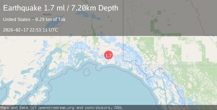
| VYTPrimary | 1.8 | 17 km | 10 hours ago |
| USGS | 1.7 | 7 km | 10 hours ago |
Earthquake Details
AutomaticEvent IDvyt_qoi9orbxg4vl
Tsunami PotentialNo
Magnitude Typeearthquake
Nearest Places
- Bremner Glacier13.8 km
- North Fork Lobe Bremner Glacier16.2 km
- Granite Creek18.6 km
- Mount Steller21.7 km
- Tana Lobe Bremner Glacier22.9 km
Comments
Join the discussion about this event.
Latest Earthquakes
1.7Mag
Southern Alaska
Time10 hours ago
Depth69.70 km
SourceVYT (Automatic)
1.0Mag
41 km NW of Toyah, Texas
Time10 hours ago
Depth3.44 km
SourceUSGS (Automatic)
2.1Mag
Potosi, Bolivia
Time10 hours ago
Depth134.64 km
SourceVYT (Automatic)
2.0Mag
WESTERN TEXAS
Time10 hours ago
Depth7.30 km
SourceTX (Automatic)
1.4Mag
WESTERN TURKEY
Time10 hours ago
Depth8.50 km
SourceAFAD (Automatic)
Nearby Earthquakes
2.7Mag
SOUTHERN ALASKA
Time1 month ago
Depth5.00 km
SourceNEIC (Automatic)
2.1Mag
Southern Alaska
Time1 day ago
Depth18.92 km
SourceVYT (Automatic)
1.7Mag
91 km S of McCarthy, Alaska
Time2 weeks ago
Depth28.20 km
SourceUSGS (Automatic)
1.3Mag
Southern Alaska
Time1 day ago
Depth17.46 km
SourceVYT (Automatic)
0.8Mag
Southern Alaska
Time1 week ago
Depth0.00 km
SourceVYT (Automatic)