Earthquake Southern Alaska
Tue, 17 Feb 2026 04:31:52 GMT
Time1 day ago
Location
60.5394, -143.0424
Depth
17.5 KM
Event Summary
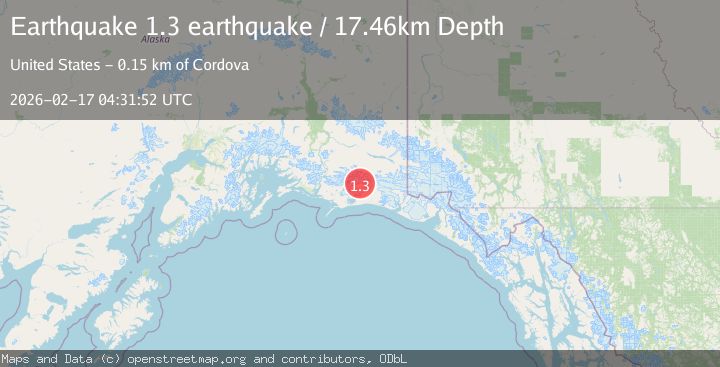
A 1.3 magnitude earthquake struck on Southern Alaska, at Tue, 17 Feb 2026 04:31:52 GMT. Depth: 17.4560546875km. Reviewed by VYT seismologists, this minor quake occurred at a magnitude type of earthquake.
Magnitude
1.3
earthquake
Source
VYT
Intensity
-
Agency Reports
1 Sources| Source | Magnitude | Depth | Time |
|---|---|---|---|
| VYTPrimary | 1.3 | 17 km | 1 day ago |
Earthquake Details
AutomaticEvent IDvyt_22y6uzzizv1i1
Tsunami PotentialNo
Magnitude Typeearthquake
Nearest Places
- Mount Steller3.9 km
- Waxell Ridge4.3 km
- Betge Glacier8.3 km
- Ovtsyn Glacier12.2 km
- Waxell Glacier14.4 km
Comments
Join the discussion about this event.
Latest Earthquakes
2.4Mag
Region Metropolitana, Chile
Time23 hours ago
Depth80.44 km
SourceVYT (Automatic)
2.4Mag
offshore Coquimbo, Chile
Time23 hours ago
Depth10.00 km
SourceVYT (Automatic)
3.2Mag
Near North Coast of West Papua
Time23 hours ago
Depth28.97 km
SourceBMKG
3.2Mag
Southeastern Alaska
Time23 hours ago
Depth0.00 km
SourceVYT (Automatic)
1.0Mag
5 km WSW of Anza, CA
Time23 hours ago
Depth7.10 km
SourceUSGS (Automatic)
Nearby Earthquakes
1.4Mag
104 km S of McCarthy, Alaska
Time2 weeks ago
Depth6.30 km
SourceUSGS (Automatic)
1.4Mag
108 km S of McCarthy, Alaska
Time1 week ago
Depth17.30 km
SourceUSGS (Automatic)
1.2Mag
108 km S of McCarthy, Alaska
Time2 weeks ago
Depth8.60 km
SourceUSGS (Automatic)
1.1Mag
108 km S of McCarthy, Alaska
Time4 days ago
Depth27.50 km
SourceUSGS (Automatic)
2.1Mag
Southern Alaska
Time1 day ago
Depth18.92 km
SourceVYT (Automatic)