Earthquake West Papua Region, Indonesia
Thu, 29 Jan 2026 19:33:49 GMT
Time3 hours ago
Location
-2.4132, 134.1922
Depth
10.0 KM
Event Summary
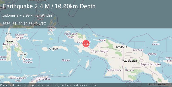
A 2.4 magnitude earthquake struck on West Papua Region, Indonesia, at Thu, 29 Jan 2026 19:33:49 GMT. Depth: 10km. Reviewed by BMKG seismologists, this minor quake occurred at a magnitude type of M.
Magnitude
2.4
M
Source
BMKG
Intensity
-
Agency Reports
1 Sources| Source | Magnitude | Depth | Time |
|---|---|---|---|
| BMKGPrimary | 2.4 | 10 km | 3 hours ago |
Earthquake Details
AutomaticEvent IDbmg2026caqw
Tsunami PotentialNo
Magnitude TypeM
Nearest Places
- Kampung Windesi1.4 km
- Windesi2.9 km
- Itiobi3.5 km
- Pulau Mutorai4.2 km
- Warianggi6.3 km
Comments
Join the discussion about this event.
Latest Earthquakes
3.0Mag
Southern Sumatra, Indonesia
Time3 hours ago
Depth23.61 km
SourceBMKG (Automatic)
2.1Mag
10 km NE of Pāhala, Hawaii
Time3 hours ago
Depth28.82 km
SourceUSGS (Automatic)
2.2Mag
Timor Region
Time3 hours ago
Depth5.01 km
SourceBMKG (Automatic)
2.5Mag
SULAWESI, INDONESIA
Time3 hours ago
Depth12.00 km
SourceBMKG (Automatic)
3.1Mag
NORTH ISLAND OF NEW ZEALAND
Time3 hours ago
Depth18.60 km
SourceGNS (Automatic)
Nearby Earthquakes
3.3Mag
West Papua Region, Indonesia
Time1 week ago
Depth10.00 km
SourceBMKG (Automatic)
2.9Mag
West Papua Region, Indonesia
Time4 days ago
Depth10.68 km
SourceBMKG (Automatic)
2.4Mag
West Papua Region, Indonesia
Time5 days ago
Depth10.00 km
SourceBMKG (Automatic)
2.7Mag
West Papua Region, Indonesia
Time5 days ago
Depth14.00 km
SourceBMKG (Automatic)
3.6Mag
West Papua Region, Indonesia
Time1 week ago
Depth10.00 km
SourceBMKG (Automatic)