Earthquake Northern Molucca Sea
Sun, 01 Feb 2026 21:46:50 GMT
Time1 day ago
Location
1.1391, 126.9394
Depth
17.0 KM
Event Summary
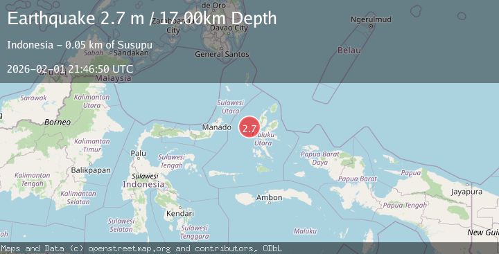
A 2.7 magnitude earthquake struck on Northern Molucca Sea, at Sun, 01 Feb 2026 21:46:50 GMT. Depth: 17.024189km. Reviewed by BMKG seismologists, this minor quake occurred at a magnitude type of M.
Magnitude
2.7
M
Source
BMKG
Intensity
-
Agency Reports
1 Sources| Source | Magnitude | Depth | Time |
|---|---|---|---|
| BMKGPrimary | 2.7 | 17 km | 1 day ago |
Earthquake Details
AutomaticEvent IDbmg2026cghs
Tsunami PotentialNo
Magnitude TypeM
Nearest Places
- Nyi44.9 km
- Pulau Maka48.3 km
- Tanjung Kao Cina48.5 km
- Kao Cina48.7 km
- Tanjung Ngofaudu48.7 km
Comments
Join the discussion about this event.
Latest Earthquakes
2.5Mag
Java, Indonesia
Time1 hour ago
Depth25.51 km
SourceBMKG (Automatic)
1.8Mag
10 km ESE of Pearsall, Texas
Time1 hour ago
Depth8.90 km
SourceUSGS (Automatic)
3.5Mag
West Papua Region, Indonesia
Time1 hour ago
Depth76.55 km
SourceBMKG (Automatic)
1.6Mag
6 km NNW of Lakeside, CA
Time1 hour ago
Depth3.33 km
SourceUSGS (Automatic)
2.8Mag
Sulawesi, Indonesia
Time1 hour ago
Depth10.00 km
SourceBMKG (Automatic)
Nearby Earthquakes
2.6Mag
Northern Molucca Sea
Time1 week ago
Depth61.16 km
SourceBMKG (Automatic)
2.9Mag
Northern Molucca Sea
Time3 days ago
Depth15.50 km
SourceBMKG (Automatic)
3.5Mag
Northern Molucca Sea
Time1 day ago
Depth16.30 km
SourceBMKG (Automatic)
3.1Mag
Halmahera, Indonesia
Time5 days ago
Depth10.16 km
SourceBMKG (Automatic)
3.1Mag
Northern Molucca Sea
Time1 week ago
Depth27.94 km
SourceBMKG (Automatic)