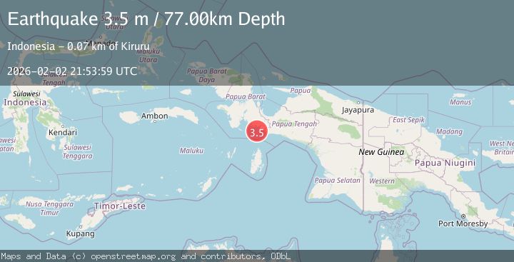
Earthquake West Papua Region, Indonesia
Mon, 02 Feb 2026 21:53:59 GMT
Time1 hour ago
Location
-4.2885, 134.5021
Depth
76.6 KM
Event Summary
A 3.5 magnitude earthquake struck on West Papua Region, Indonesia, at Mon, 02 Feb 2026 21:53:59 GMT. Depth: 76.553902km. Reviewed by BMKG seismologists, this minor quake occurred at a magnitude type of M.
Magnitude
3.5
M
Source
BMKG
Intensity
-
Agency Reports
1 Sources| Source | Magnitude | Depth | Time |
|---|---|---|---|
| BMKGPrimary | 3.5 | 77 km | 1 hour ago |
Earthquake Details
AutomaticEvent IDbmg2026cidl
Tsunami PotentialNo
Magnitude TypeM
Nearest Places
- Tanjung Bohia21.4 km
- Pulau Lakahia26.4 km
- Tanjung Awuro27.3 km
- Sungai Omba27.9 km
- Modowi28.1 km
Comments
Join the discussion about this event.
Latest Earthquakes
1.6Mag
6 km NNW of Lakeside, CA
Time1 hour ago
Depth3.33 km
SourceUSGS (Automatic)
2.8Mag
Sulawesi, Indonesia
Time1 hour ago
Depth10.00 km
SourceBMKG (Automatic)
1.5Mag
5 km SE of San Ramon, CA
Time2 hours ago
Depth6.55 km
SourceUSGS (Automatic)
3.1Mag
NEAR S.E. COAST OF AUSTRALIA
Time2 hours ago
Depth10.00 km
SourceAUST (Automatic)
3.8Mag
Southern Sumatra, Indonesia
Time2 hours ago
Depth10.00 km
SourceBMKG (Automatic)
Nearby Earthquakes
2.9Mag
West Papua Region, Indonesia
Time1 week ago
Depth10.00 km
SourceBMKG (Automatic)
3.9Mag
West Papua Region, Indonesia
Time18 hours ago
Depth61.54 km
SourceBMKG (Automatic)
3.8Mag
NEAR S COAST OF PAPUA, INDONESIA
Time1 week ago
Depth54.00 km
SourceBMKG (Automatic)
2.9Mag
West Papua Region, Indonesia
Time5 days ago
Depth8.13 km
SourceBMKG (Automatic)
3.5Mag
West Papua Region, Indonesia
Time3 hours ago
Depth10.00 km
SourceBMKG (Automatic)