Earthquake West Papua Region, Indonesia
Mon, 02 Feb 2026 05:25:26 GMT
Time19 hours ago
Location
-4.4539, 134.4351
Depth
61.5 KM
Event Summary
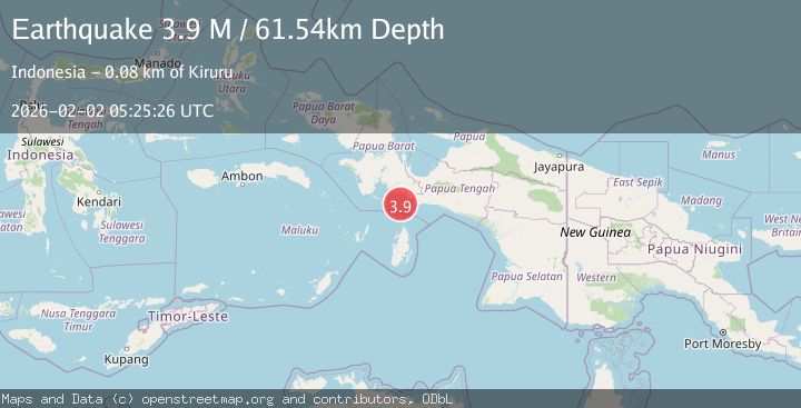
A 3.9 magnitude earthquake struck on West Papua Region, Indonesia, at Mon, 02 Feb 2026 05:25:26 GMT. Depth: 61.536182km. Reviewed by BMKG seismologists, this minor quake occurred at a magnitude type of M.
Magnitude
3.9
M
Source
BMKG
Intensity
-
Agency Reports
1 Sources| Source | Magnitude | Depth | Time |
|---|---|---|---|
| BMKGPrimary | 3.9 | 62 km | 19 hours ago |
Earthquake Details
AutomaticEvent IDbmg2026cgwv
Tsunami PotentialNo
Magnitude TypeM
Nearest Places
- Tanjung Bohia40.9 km
- Sungai Omba43.7 km
- Omba44.3 km
- Pulau Lakahia46.2 km
- Tanjung Awuro46.4 km
Comments
Join the discussion about this event.
Latest Earthquakes
1.0Mag
14 km SW of Searles Valley, CA
Time20 hours ago
Depth4.19 km
SourceUSGS (Automatic)
1.7Mag
36 km W of Empire, Nevada
Time20 hours ago
Depth4.93 km
SourceUSGS (Automatic)
1.5Mag
6 km SSE of Malibu Beach, CA
Time20 hours ago
Depth12.80 km
SourceUSGS (Automatic)
1.1Mag
WESTERN TURKEY
Time20 hours ago
Depth7.00 km
SourceAFAD (Automatic)
2.4Mag
Sumba Region, Indonesia
Time20 hours ago
Depth66.34 km
SourceBMKG (Automatic)
Nearby Earthquakes
2.9Mag
West Papua Region, Indonesia
Time1 week ago
Depth10.00 km
SourceBMKG (Automatic)
3.8Mag
NEAR S COAST OF PAPUA, INDONESIA
Time1 week ago
Depth54.00 km
SourceBMKG (Automatic)
3.7Mag
West Papua Region, Indonesia
Time1 day ago
Depth29.83 km
SourceBMKG (Automatic)
2.9Mag
West Papua Region, Indonesia
Time5 days ago
Depth8.13 km
SourceBMKG (Automatic)
3.0Mag
West Papua Region, Indonesia
Time1 week ago
Depth13.42 km
SourceBMKG (Automatic)