Earthquake 121 km NW of Yakutat, Alaska
Sun, 04 Jan 2026 01:08:10 GMT
Time3 days ago
Location
60.3130, -141.2700
Depth
12.1 KM
Event Summary
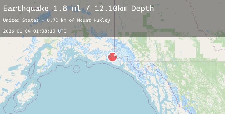
A 1.8 magnitude earthquake struck on 121 km NW of Yakutat, Alaska, at Sun, 04 Jan 2026 01:08:10 GMT. Depth: 12.1km. Reviewed by USGS seismologists, this minor quake occurred at a magnitude type of ml.
Magnitude
1.8
ml
Source
USGS
Intensity
-
Agency Reports
1 Sources| Source | Magnitude | Depth | Time |
|---|---|---|---|
| USGSPrimary | 1.8 | 12 km | 3 days ago |
Earthquake Details
AutomaticEvent IDusgs_ak2026afplka
Tsunami PotentialNo
Magnitude Typeml
Nearest Places
- Mount Huxley6.7 km
- Crater Basin7.5 km
- The Hump10.5 km
- Coal Glacier11.5 km
- Columbus Glacier14.5 km
Comments
Join the discussion about this event.
Latest Earthquakes
3.1Mag
West Papua, Indonesia
Time3 days ago
Depth10.00 km
SourceBMKG (Automatic)
2.0Mag
85 km N of Yakutat, Alaska
Time3 days ago
Depth1.50 km
SourceUSGS (Automatic)
1.1Mag
9 km NW of The Geysers, CA
Time3 days ago
Depth11.99 km
SourceUSGS (Automatic)
2.7Mag
MEGHALAYA, INDIA REGION
Time3 days ago
Depth10.00 km
SourceNDI (Automatic)
1.5Mag
EASTERN TURKEY
Time3 days ago
Depth7.00 km
SourceAFAD (Automatic)
Nearby Earthquakes
2.0Mag
85 km N of Yakutat, Alaska
Time3 days ago
Depth1.50 km
SourceUSGS (Automatic)
1.9Mag
115 km WNW of Yakutat, Alaska
Time3 days ago
Depth5.00 km
SourceUSGS (Automatic)
1.6Mag
114 km NW of Yakutat, Alaska
Time3 days ago
Depth15.30 km
SourceUSGS (Automatic)
1.9Mag
90 km NW of Yakutat, Alaska
Time3 days ago
Depth17.80 km
SourceUSGS (Automatic)
1.7Mag
77 km NW of Yakutat, Alaska
Time3 days ago
Depth18.60 km
SourceUSGS (Automatic)