Earthquake 31 km NE of Four Mile Road, Alaska
Mon, 02 Feb 2026 02:41:53 GMT
Time20 hours ago
Location
64.8190, -148.6980
Depth
11.6 KM
Event Summary
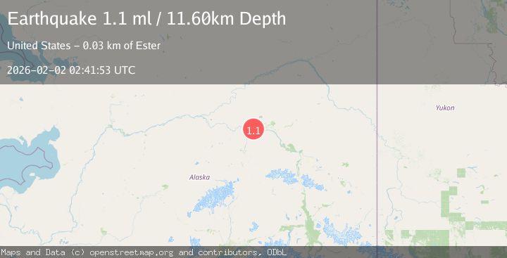
A 1.1 magnitude earthquake struck on 31 km NE of Four Mile Road, Alaska, at Mon, 02 Feb 2026 02:41:53 GMT. Depth: 11.6km. Reviewed by USGS seismologists, this minor quake occurred at a magnitude type of ml.
Magnitude
1.1
ml
Source
USGS
Intensity
-
Agency Reports
1 Sources| Source | Magnitude | Depth | Time |
|---|---|---|---|
| USGSPrimary | 1.1 | 12 km | 20 hours ago |
Earthquake Details
AutomaticEvent IDusgs_ak2026cgyprn
Tsunami PotentialNo
Magnitude Typeml
Nearest Places
- California4.0 km
- Section House6.6 km
- Glacier Creek7.4 km
- Dunbar8.1 km
- Standard9.0 km
Comments
Join the discussion about this event.
Latest Earthquakes
2.2Mag
7 km S of Badger, Alaska
Time11 minutes ago
Depth19.20 km
SourceUSGS (Automatic)
1.9Mag
87 km N of Yakutat, Alaska
Time23 minutes ago
Depth5.00 km
SourceUSGS (Automatic)
1.8Mag
44 km NW of Tatitlek, Alaska
Time27 minutes ago
Depth17.80 km
SourceUSGS (Automatic)
2.3Mag
Flores Region, Indonesia
Time28 minutes ago
Depth17.19 km
SourceBMKG (Automatic)
3.6Mag
Sumbawa Region, Indonesia
Time29 minutes ago
Depth14.84 km
SourceBMKG (Automatic)
Nearby Earthquakes
1.0Mag
32 km W of Ester, Alaska
Time1 day ago
Depth13.50 km
SourceUSGS (Automatic)
1.2Mag
28 km NE of Four Mile Road, Alaska
Time14 hours ago
Depth5.00 km
SourceUSGS (Automatic)
0.7Mag
22 km NE of Four Mile Road, Alaska
Time6 days ago
Depth28.90 km
SourceUSGS (Automatic)
1.3Mag
20 km NNE of Four Mile Road, Alaska
Time4 days ago
Depth5.00 km
SourceUSGS (Automatic)
1.7Mag
18 km WSW of Ester, Alaska
Time1 week ago
Depth6.50 km
SourceUSGS (Automatic)