Earthquake 13 km NE of Ridgecrest, CA
Mon, 02 Feb 2026 12:42:07 GMT
Time6 hours ago
Location
35.7132, -117.5820
Depth
6.9 KM
Event Summary
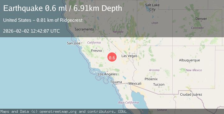
A 0.6 magnitude earthquake struck on 13 km NE of Ridgecrest, CA, at Mon, 02 Feb 2026 12:42:07 GMT. Depth: 6.91km. Reviewed by USGS seismologists, this minor quake occurred at a magnitude type of ml.
Magnitude
0.6
ml
Source
USGS
Intensity
-
Agency Reports
1 Sources| Source | Magnitude | Depth | Time |
|---|---|---|---|
| USGSPrimary | 0.6 | 7 km | 6 hours ago |
Earthquake Details
AutomaticEvent IDusgs_ci41178127
Tsunami PotentialNo
Magnitude Typeml
Nearest Places
- China Lake3.1 km
- Lark Seep4.2 km
- Lone Butte5.5 km
- Trona Water Pipeline6.0 km
- Landmark Letter7.0 km
Comments
Join the discussion about this event.
Latest Earthquakes
2.3Mag
Minahassa Peninsula, Sulawesi
Time8 minutes ago
Depth50.17 km
SourceBMKG (Automatic)
1.2Mag
11 km NE of Julian, CA
Time8 minutes ago
Depth10.31 km
SourceUSGS (Automatic)
2.7Mag
MOLUCCA SEA
Time8 minutes ago
Depth28.00 km
SourceBMKG (Automatic)
2.5Mag
Java, Indonesia
Time16 minutes ago
Depth78.16 km
SourceBMKG (Automatic)
2.8Mag
WEST OF AUSTRALIA
Time18 minutes ago
Depth10.00 km
SourceAUST (Automatic)
Nearby Earthquakes
1.3Mag
Central California
Time1 week ago
Depth8.95 km
SourceUSGS (Automatic)
1.4Mag
14 km NE of Ridgecrest, CA
Time20 hours ago
Depth8.20 km
SourceUSGS (Automatic)
1.7Mag
15 km WSW of Searles Valley, CA
Time1 week ago
Depth4.02 km
SourceUSGS (Automatic)
0.7Mag
15 km NNE of Ridgecrest, CA
Time1 day ago
Depth10.28 km
SourceUSGS (Automatic)
1.6Mag
13 km ENE of Ridgecrest, CA
Time3 days ago
Depth7.78 km
SourceUSGS (Automatic)