Earthquake 17 km W of Searles Valley, CA
Mon, 09 Feb 2026 16:53:45 GMT
Time3 hours ago
Location
35.7667, -117.5978
Depth
7.4 KM
Event Summary
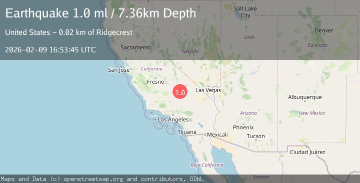
A 1.0 magnitude earthquake struck on 17 km W of Searles Valley, CA, at Mon, 09 Feb 2026 16:53:45 GMT. Depth: 7.3600001335144km. Reviewed by USGS seismologists, this minor quake occurred at a magnitude type of ml.
Magnitude
1.0
ml
Source
USGS
Intensity
-
Agency Reports
1 Sources| Source | Magnitude | Depth | Time |
|---|---|---|---|
| USGSPrimary | 1.0 | 7 km | 3 hours ago |
Earthquake Details
AutomaticEvent IDusgs_ci41394464
Tsunami PotentialNo
Magnitude Typeml
Nearest Places
- Burro Canyon4.1 km
- Paxton Ranch4.2 km
- Burro Canyon Test Facility4.9 km
- China Lake5.0 km
- Deadman Canyon6.4 km
Comments
Join the discussion about this event.
Latest Earthquakes
3.6Mag
RYUKYU ISLANDS, JAPAN
Time22 minutes ago
Depth10.00 km
SourceJMA (Automatic)
1.3Mag
4 km SSE of Mentone, CA
Time24 minutes ago
Depth10.32 km
SourceUSGS (Automatic)
3.1Mag
ARUNACHAL PRADESH, INDIA
Time25 minutes ago
Depth10.00 km
SourceNDI (Automatic)
2.2Mag
Sumbawa Region, Indonesia
Time26 minutes ago
Depth109.78 km
SourceBMKG (Automatic)
1.1Mag
11 km NNE of Ramona, CA
Time30 minutes ago
Depth14.98 km
SourceUSGS (Automatic)
Nearby Earthquakes
1.1Mag
18 km NNE of Ridgecrest, CA
Time1 day ago
Depth10.09 km
SourceUSGS (Automatic)
0.5Mag
17 km W of Searles Valley, CA
Time1 week ago
Depth9.98 km
SourceUSGS (Automatic)
1.5Mag
17 km NNE of Ridgecrest, CA
Time1 week ago
Depth8.41 km
SourceUSGS (Automatic)
1.1Mag
16 km W of Searles Valley, CA
Time5 days ago
Depth8.52 km
SourceUSGS (Automatic)
0.7Mag
15 km NNE of Ridgecrest, CA
Time1 week ago
Depth10.28 km
SourceUSGS (Automatic)