Earthquake 18 km NNE of Ridgecrest, CA
Sat, 07 Feb 2026 22:26:14 GMT
Time1 hour ago
Location
35.7677, -117.6030
Depth
10.1 KM
Event Summary
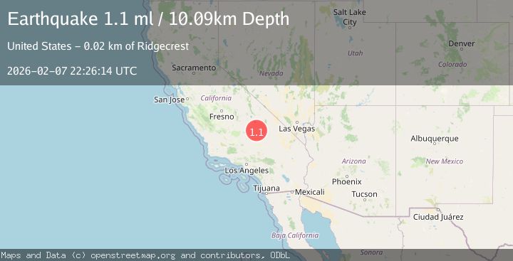
A 1.1 magnitude earthquake struck on 18 km NNE of Ridgecrest, CA, at Sat, 07 Feb 2026 22:26:14 GMT. Depth: 10.0900001525879km. Reviewed by USGS seismologists, this minor quake occurred at a magnitude type of ml.
Magnitude
1.1
ml
Source
USGS
Intensity
-
Agency Reports
1 Sources| Source | Magnitude | Depth | Time |
|---|---|---|---|
| USGSPrimary | 1.1 | 10 km | 1 hour ago |
Earthquake Details
AutomaticEvent IDusgs_ci41393624
Tsunami PotentialNo
Magnitude Typeml
Nearest Places
- Paxton Ranch3.9 km
- Burro Canyon4.2 km
- China Lake5.0 km
- Burro Canyon Test Facility5.1 km
- Deadman Canyon6.4 km
Comments
Join the discussion about this event.
Latest Earthquakes
4.4Mag
Northern Molucca Sea
Time4 minutes ago
Depth13.92 km
SourceBMKG (Automatic)
3.2Mag
Sunda Strait, Indonesia
Time9 minutes ago
Depth22.53 km
SourceBMKG (Automatic)
2.2Mag
Java, Indonesia
Time14 minutes ago
Depth12.80 km
SourceBMKG (Automatic)
3.5Mag
West Papua Region, Indonesia
Time22 minutes ago
Depth60.58 km
SourceBMKG (Automatic)
1.9Mag
STRAIT OF GIBRALTAR
Time28 minutes ago
Depth19.40 km
SourceIGN (Automatic)
Nearby Earthquakes
0.5Mag
17 km W of Searles Valley, CA
Time1 week ago
Depth9.98 km
SourceUSGS (Automatic)
1.5Mag
17 km NNE of Ridgecrest, CA
Time1 week ago
Depth8.41 km
SourceUSGS (Automatic)
1.1Mag
16 km W of Searles Valley, CA
Time3 days ago
Depth8.52 km
SourceUSGS (Automatic)
0.7Mag
15 km NNE of Ridgecrest, CA
Time6 days ago
Depth10.28 km
SourceUSGS (Automatic)
0.6Mag
19 km NNE of Ridgecrest, CA
Time2 weeks ago
Depth8.30 km
SourceUSGS (Automatic)