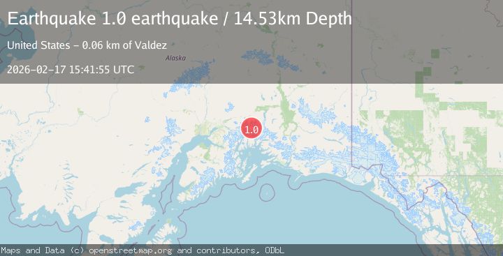
Earthquake Southern Alaska
Tue, 17 Feb 2026 15:41:55 GMT
Time17 hours ago
Location
61.4678, -147.2633
Depth
14.5 KM
Event Summary
A 1.0 magnitude earthquake struck on Southern Alaska, at Tue, 17 Feb 2026 15:41:55 GMT. Depth: 14.5263671875km. Reviewed by VYT seismologists, this minor quake occurred at a magnitude type of earthquake.
Magnitude
1.0
earthquake
Source
VYT
Intensity
-
Agency Reports
1 Sources| Source | Magnitude | Depth | Time |
|---|---|---|---|
| VYTPrimary | 1.0 | 15 km | 17 hours ago |
Earthquake Details
AutomaticEvent IDvyt_pt7z9olhxlw5
Tsunami PotentialNo
Magnitude Typeearthquake
Nearest Places
- Mount Gilbert Lewis6.1 km
- Mount Thor6.5 km
- Mount Edison7.8 km
- Mount Elusive8.5 km
- Mount Witherspoon8.7 km
Comments
Join the discussion about this event.
Latest Earthquakes
1.5Mag
Southern Alaska
Time17 hours ago
Depth67.26 km
SourceVYT (Automatic)
2.4Mag
Northern Sumatra, Indonesia
Time17 hours ago
Depth8.31 km
SourceBMKG
1.2Mag
10 km NW of The Geysers, CA
Time17 hours ago
Depth1.41 km
SourceUSGS (Automatic)
3.5Mag
Kepulauan Mentawai region, Indonesia
Time17 hours ago
Depth29.42 km
SourceVYT (Automatic)
0.8Mag
30 km ESE of Lake Isabella, CA
Time17 hours ago
Depth6.21 km
SourceUSGS (Automatic)
Nearby Earthquakes
1.9Mag
47 km SSE of Glacier View, Alaska
Time2 weeks ago
Depth18.50 km
SourceUSGS (Automatic)
3.0Mag
SOUTHERN ALASKA
Time5 years ago
Depth16.00 km
SourceNEIC (Automatic)
1.3Mag
Southern Alaska
Time2 days ago
Depth0.00 km
SourceVYT (Automatic)
3.0Mag
SOUTHERN ALASKA
Time2 years ago
Depth12.00 km
SourceAK (Automatic)
1.5Mag
Southern Alaska
Time23 hours ago
Depth0.00 km
SourceVYT (Automatic)