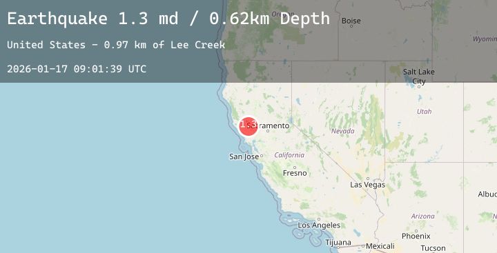
Earthquake 2 km N of The Geysers, CA
Sat, 17 Jan 2026 09:01:39 GMT
Time2 hours ago
Location
38.7942, -122.7605
Depth
0.6 KM
Event Summary
A 1.3 magnitude earthquake struck on 2 km N of The Geysers, CA, at Sat, 17 Jan 2026 09:01:39 GMT. Depth: 0.620000004768372km. Reviewed by USGS seismologists, this minor quake occurred at a magnitude type of md.
Magnitude
1.3
md
Source
USGS
Intensity
-
Agency Reports
4 Sources| Source | Magnitude | Depth | Time |
|---|---|---|---|
| USGSPrimary | 1.3 | 1 km | 2 hours ago |
| USGSPrimary | 1.3 | 3 km | 1 hour ago |
| USGSPrimary | 0.9 | 2 km | 1 hour ago |
| USGSPrimary | 0.7 | 1 km | 1 hour ago |
Earthquake Details
AutomaticEvent IDusgs_nc75296966
Tsunami PotentialNo
Magnitude Typemd
Nearest Places
- Burned Mountain1.1 km
- Smudgeo Number 1 Heliport1.2 km
- Hot Springs Creek2.0 km
- The Geysers2.2 km
- Geyser Rock2.3 km
Comments
Join the discussion about this event.
Latest Earthquakes
1.5Mag
58 km NW of Toyah, Texas
Time42 minutes ago
Depth4.17 km
SourceUSGS (Automatic)
1.7Mag
23 km W of Skwentna, Alaska
Time52 minutes ago
Depth93.90 km
SourceUSGS (Automatic)
1.4Mag
EASTERN TURKEY
Time1 hour ago
Depth7.00 km
SourceAFAD (Automatic)
2.9Mag
Sumba Region, Indonesia
Time1 hour ago
Depth43.65 km
SourceBMKG (Automatic)
2.7Mag
Timor Region
Time1 hour ago
Depth63.53 km
SourceBMKG (Automatic)
Nearby Earthquakes
1.8Mag
7 km NW of The Geysers, CA
Time1 hour ago
Depth0.99 km
SourceUSGS (Automatic)
1.4Mag
8 km NW of The Geysers, CA
Time3 hours ago
Depth1.91 km
SourceUSGS (Automatic)
1.3Mag
6 km NNW of The Geysers, CA
Time4 hours ago
Depth1.87 km
SourceUSGS (Automatic)
1.3Mag
2 km NNW of The Geysers, CA
Time5 hours ago
Depth3.48 km
SourceUSGS (Automatic)
1.4Mag
9 km WNW of The Geysers, CA
Time7 hours ago
Depth2.36 km
SourceUSGS (Automatic)